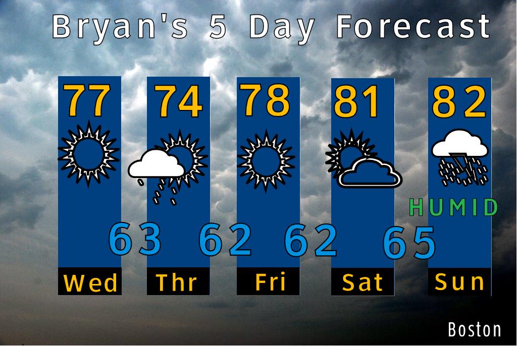
A strong low pressure area and moisture (some remnants of Tropical Storm Don) move into New England late on the day Saturday. The cold front slows down as a strong area of low pressure tracks across the St. Lawrence valley. This will keep the threat for showers and a thunderstorm over New England until early Monday.
It is this front that will push Emily out to sea off the Carolina coast and not bring her into New England.
 |
| Emily will likely approach the US East Coast, but remain offshore, and curve out to sea off of NC and not have an impact in New England, except for some higher surf out on the Cape later next week. |
No comments:
Post a Comment