I sure hope that many of you enjoyed yesterdays record smashing high temperature of 74 in Boston during the last days of Winter 2012! That was nothing!! I hope you are ready for some mid to upper 80s by mid week!!
The Vernal (Spring) Equinox begins at 1:14 AM tonight, as we now will have more daylight and less darkness.
Today however, one of those pesky cold ocean backdoor cold fronts will push into coastal New England, providing a sharp line between warmth and chilly air. It will be short lived. Many will see temperatures rise to the lower to mid 60s by noon today, then a backdoor front tries to push westward but only makes it into extreme eastern MA.
 | |
| A backdoor cold front will start along the coast of MA around Noon and push inland throughout the afternoon, dropping temperatures dramatically. Shown are the temperatures for NOON and 4 PM in areas that will see frontal passage. Overnight lows will be chilly into the 30s for most areas. The front reaches the CT river valley by 8 PM. |
 |
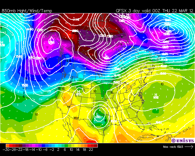
| A typical summer pattern sets up along the east coast with a Bermuda high bringing in warm air from the Caribbean all the way into New England this week. |
 |
| The heat arrives on Thursday, full force with highs reaching the mid and upper 80s in some areas. Coastal areas will be much cooler. |

No comments:
Post a Comment