Friday Forecast: Morning fog, burns off to partly cloudy skies, a possible shower of thunderstorm late. High of 67.
Saturday looks to be a decent day. It will start out with some sun in the morning with building clouds after 12pm with the possibility of a scattered shower or thunderstorm, clearing by late afternoon and early evening. Cooler at the coast. Mid 70's inland, mid 60's coast.
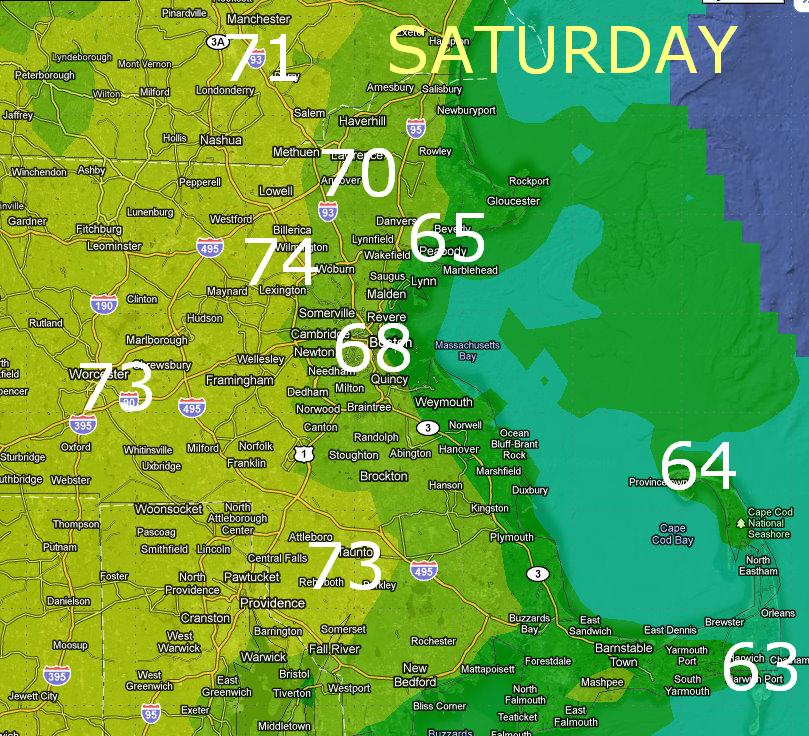 |
| Saturday's High Temperatures |
Sunday a backdoor cold front pushes into the area and expect a sunny day but temperatures about 7-10 degrees colder than Saturday.
Luckily it is short lived and warmer air returns with more sun for the week. There is the chance for a passing shower on Monday, but with temperatures around 70 going up to near 80 on Tuesday and Wednesday, it will feel more like May, than early April.
P-town forecast: Friday mix of sun and clouds a chance of a shower Low of 50
Saturday mix of Sun and clouds chance of a shower High of 64
Sunday much cooler, possible fog mixed with sun High of 55
Water temperature: 49
No comments:
Post a Comment